Every winter, millions of students and parents face the same question: will school be open tomorrow? For decades, this meant obsessively checking local news stations and hoping for a phone call before bedtime. Today, a snow day calculator can give you a data-driven probability score hours before official announcements — and the best ones are accurate 80–85% of the time.
But how does a snow day calculator actually work? What separates a reliable prediction tool from a random number generator? And more importantly, how do you read the results to make informed decisions about tomorrow's schedule?
This guide breaks down everything you need to know about snow day calculators — from the weather data they analyze to the machine learning models that power modern predictions.
How a Snow Day Calculator Actually Works
A legitimate snow day calculator operates as a specialized weather analysis engine built for one specific task: predicting whether schools in your area will close or delay due to winter weather. Here's the process a modern AI-powered calculator follows:
Step 1: Real-Time Weather Data Collection
The calculator pulls forecast data from meteorological APIs like Open-Meteo, NOAA, or Weather.gov. This isn't tomorrow's general forecast — it's hyper-granular hourly predictions for your exact coordinates including snowfall rate, accumulation timing, temperature, wind speed, visibility, and precipitation type (snow, sleet, freezing rain).
Step 2: District Profile Matching
When you enter your ZIP code or city, the calculator matches you to a school district closure profile. This profile contains:
- Historical closure data: every weather-related closure and delay from the past 5–10 years
- Threshold sensitivity: how much snow/ice/cold it typically takes to close this specific district
- Regional patterns: whether this district closes more or less readily than neighboring areas
- Infrastructure factors: bus-heavy districts vs. walking districts, urban vs. rural road networks
Step 3: Machine Learning Prediction Model
The calculator feeds all this data into a trained machine learning model that has analyzed thousands of past snow events and their outcomes. The model identifies patterns that human forecasters might miss — like the fact that 4 inches of snow forecast to fall between 5–8 AM produces closures 85% of the time, while the same 4 inches falling 10 AM–1 PM only closes schools 20% of the time.
The output is a probability score: the percentage likelihood that your district will close or delay based on the specific combination of weather conditions, timing, and historical patterns.
The 7 Weather Factors That Determine School Closures
Not all winter weather carries equal weight in closure decisions. A snow day calculator analyzes these factors in a weighted hierarchy — and understanding this hierarchy helps you interpret the predictions correctly:
| Factor | Weight | Critical Threshold | Why It Matters |
|---|---|---|---|
| Snowfall timing | 35% | Peak between 5–9 AM | Heaviest snow during commute = highest closure probability |
| Total accumulation | 25% | 4–6 inches (varies by region) | Raw total matters, but timing matters more |
| Wind chill | 15% | Below −15°F | Extreme cold can close schools with zero snowfall |
| Ice/freezing rain | 12% | 0.1 inch ice accumulation | Ice is more dangerous than snow — smaller amounts trigger closures |
| Visibility | 8% | Below 0.25 miles | Whiteout conditions make driving impossible regardless of totals |
| Road temperature | 3% | Below 28°F during snowfall | Determines whether snow sticks or melts on pavement |
| Forecast confidence | 2% | Model agreement <70% | Low-confidence forecasts reduce prediction reliability |
Notice that timing outweighs total accumulation. This is the single most misunderstood aspect of snow day predictions. A forecast of 3 inches falling from 6–9 AM deserves a higher closure probability than 6 inches falling from noon–6 PM — because the morning storm directly interferes with bus routes and the commute window, while the afternoon storm hits after most students are already in school.
Understanding Probability Scores: What the Numbers Mean
A snow day calculator returns a probability percentage, but that number requires context to interpret correctly. Here's how to read the score based on your district's historical behavior:
High-Tolerance Districts (Buffalo, Minneapolis, Denver)
- 85%+ probability: School will almost certainly close
- 70–84%: Closure very likely; start making backup plans
- 50–69%: Genuine toss-up; watch for morning updates
- 30–49%: More likely open than closed, but not guaranteed
- Below 30%: School will almost certainly be open
Low-Tolerance Districts (Atlanta, Nashville, Charlotte)
- 70%+ probability: School will almost certainly close
- 50–69%: Closure very likely
- 35–49%: Genuine toss-up
- 20–34%: More likely open than closed
- Below 20%: School will almost certainly be open
The thresholds shift because districts with lower tolerance close more readily — so a 60% score in Atlanta represents a stronger signal than 60% in Buffalo. A good Snow Day Calculator adjusts these thresholds automatically based on your location.
The confidence rating matters as much as the probability score. A 75% prediction with "high confidence" is far more reliable than a 75% prediction with "low confidence" — the latter means the weather forecast itself is uncertain, introducing additional prediction error beyond the model.
Why District-Specific Calibration Matters
One of the biggest differences between a basic snow day calculator and an accurate one is district-level calibration. Two school districts just 20 miles apart can have dramatically different closure behaviors, even when facing identical weather.
Consider these real examples from the 2024–25 winter season:
Factors that create district-to-district variation include:
- Transportation infrastructure: Bus-dependent districts close more readily than walking districts
- Road priority: Districts on major state routes get plowed earlier than those on county roads
- Budget constraints: Some districts can afford more aggressive pre-treatment; others cannot
- Superintendent philosophy: Some administrators err toward caution, others toward keeping schools open
- Recent history: A district that kept schools open during a storm that caused accidents will close more readily the next time
An accurate snow day calculator must account for all these variables. That's why entering your specific ZIP code or city produces better results than selecting a broad region — the calculator can match you to your exact district's historical closure profile rather than using a generic state or county average.
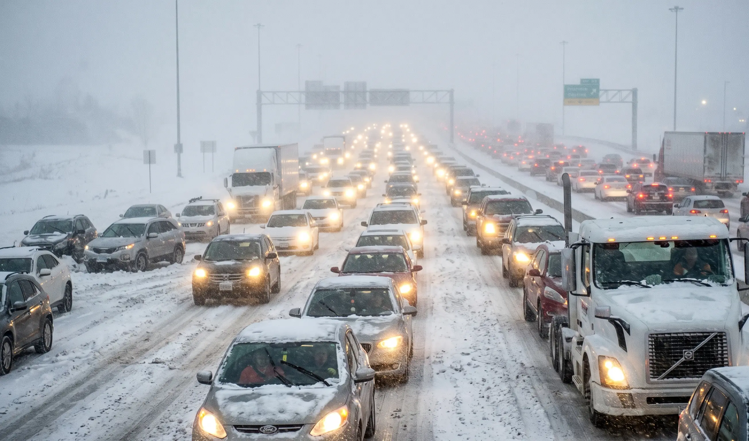
Extreme wind chill can cause traffic jam.
When to Check for Maximum Accuracy
Weather forecasts improve as you get closer to the event. A snow prediction made 5 days out is far less accurate than one made 12 hours out. For snow day predictions, timing your check correctly makes a measurable difference in accuracy:
Optimal Check Windows
10–11 PM the night before: This is the sweet spot. Evening weather model runs (typically completed by 9 PM) incorporate the day's observational data and provide the most accurate overnight snowfall predictions. Forecast confidence is high, but it's early enough to make childcare plans if needed.
5–6 AM the morning of: Useful for catching last-minute forecast changes or observing actual conditions versus predictions. However, by this time many districts have already made their decision (typically between 4:30–6 AM), so you're often checking to confirm what's already been announced rather than getting ahead of it.
When NOT to Check
Afternoon or early evening (3–7 PM): Weather models haven't updated yet with evening data, so you're looking at stale information from the morning run. Forecasts can change significantly overnight.
More than 48 hours before: Long-range snow forecasts are notoriously unreliable. A storm predicted 4 days out can shift 100 miles in any direction, change intensity, or disappear entirely. Don't stress about a snow day prediction made on Monday for Thursday — check again Wednesday night.
5 Common Mistakes People Make Reading Snow Day Predictions
1. Focusing Only on Total Snowfall
The forecast says 7 inches, so school will definitely close, right? Not necessarily. Seven inches falling from 10 PM–4 AM with clearing by sunrise often means school opens normally — roads can be treated overnight. Seven inches falling from 6–10 AM almost always closes schools because it hits during the commute. Total matters less than timing.
2. Ignoring the Confidence Rating
A 70% probability with "low confidence" is not the same as 70% with "high confidence." The former means the weather forecast itself is uncertain — models disagree, or the storm track is unpredictable — which introduces additional error. In low-confidence situations, trust the prediction less and watch for morning updates.
3. Comparing Across Different Districts
"The calculator says 65% for us but my friend in the next town over has 45% — they must be wrong!" Not necessarily. Different districts have different thresholds. Your district might close more readily due to more rural roads, older buses, or a more cautious superintendent. The same weather can legitimately produce different closure probabilities for different districts.
4. Checking Too Early
Checking the calculator at 2 PM for tomorrow's potential snow day gives you information based on the morning weather model run — which will be updated and potentially change significantly by evening. The prediction you see at 2 PM may be completely different from what you see at 10 PM using the same calculator.
5. Treating the Prediction as a Guarantee
An 85% probability is not a certainty. It means that in past storms with similar conditions, schools closed 85% of the time and stayed open 15% of the time. Every district superintendent makes the final call based on factors the calculator can't know — like whether they have makeups left in the calendar, whether there's a state assessment scheduled, or whether political pressure exists to keep schools open.
Will Your School Close Tomorrow?
Get an instant AI-powered snow day probability for your district. Our calculator uses live weather data and district-specific calibration for 85% accuracy.
❄️ Check Your Snow Day ProbabilityFrequently Asked Questions
How does a snow day calculator work?
A snow day calculator analyzes live weather forecast data including snowfall totals, timing, wind chill, ice accumulation, and visibility. It compares these conditions against your school district's historical closure patterns and tolerance thresholds to calculate a probability score. Advanced calculators use machine learning trained on thousands of past weather events and closure decisions to identify patterns that predict closures with 80–85% accuracy.
Are snow day calculators accurate?
Modern AI-powered snow day calculators achieve 80–85% accuracy when predictions are made the evening before a potential snow day. Accuracy improves to 90%+ for predictions made the morning of. The key factors that determine accuracy are: using live weather API data rather than static forecasts, district-specific calibration rather than broad regional averages, and proper weighting of forecast timing versus total accumulation.
What probability score means school will likely close?
Probability scores above 70% indicate a high likelihood of closure for most districts. Scores between 50–70% represent genuine uncertainty where the decision could go either way. Below 50% means closure is unlikely. However, these thresholds vary by district tolerance — a 60% score in a low-tolerance district like Atlanta may be more meaningful than 60% in a high-tolerance district like Buffalo or Minneapolis.
When should I check a snow day calculator?
The optimal time is 10–11 PM the night before a potential snow day. Evening weather model runs incorporate the most recent data and provide the most accurate overnight snowfall predictions. Morning checks at 5–6 AM can capture last-minute forecast changes, but the night-before prediction is usually the most reliable for planning purposes. Avoid checking in the afternoon or early evening when you're seeing stale data from the morning model run.
Can a snow day calculator predict delays versus full closures?
Advanced calculators can differentiate between 2-hour delays and full closures based on storm timing and intensity patterns. If heavy snow is forecast to end by 6–7 AM with rapid improvement, the calculator may predict a delay rather than closure. Storms peaking during the 6–9 AM commute window typically result in full closure predictions. Some calculators provide separate probability scores for delays and closures.
Why do different snow day calculators give different predictions?
Different calculators use different data sources, algorithms, and calibration methods. A calculator using generic regional data will produce different results than one using district-specific historical closure patterns. The weather API source matters too — NOAA, Open-Meteo, and Weather.gov can have different snowfall predictions for the same location and time. The most accurate calculators combine multiple forecast sources and use machine learning trained on actual closure outcomes.
Do snow day calculators work for ice storms and extreme cold?
Yes, comprehensive snow day calculators analyze ice accumulation (freezing rain) and wind chill in addition to snowfall. Ice storms can close schools with accumulations as low as 0.1 inches because ice makes roads impassable even with minimal precipitation. Extreme cold closures typically occur when wind chills drop below −15°F to −20°F, varying by region. Some northern districts have higher cold tolerance than southern districts.