You open a snow day calculator, type in your zip code, and get back a number: 67%. Now what? Is that a snow day? Should you call your boss? Does "67%" mean you have a two-thirds chance of sleeping in — or is it more nuanced than that?
Probability-based snow day calculators are far more useful than simple yes/no predictors, but only if you know how to read the output. This guide explains exactly how the probability percentage is generated, what makes it go up or down, how it changes as a storm approaches, and — critically — how to translate a number into a real decision about your Tuesday morning.
The Snow Day Calculator from SnowDay Calculation outputs probability scores for full cancellation, 2-hour delayed start, and normal operations separately. If you want the number right now, it's one zip code away. If you want to understand what you're looking at, keep reading.
Why Snow Day Predictions Use Probability, Not Yes/No
Binary predictions — "yes, snow day" or "no, school is open" — feel satisfying but are actually less useful than a probability score. Here's why:
Imagine two storms. Storm A has a 51% closure probability. Storm B has a 94% closure probability. Under a yes/no system, both round to "yes, snow day." But those two situations should produce completely different responses from a parent: Storm A is a coin flip that warrants a tentative backup plan. Storm B is near-certain and warrants fully committing to alternative arrangements.
Probability scores preserve that critical distinction. They reflect the genuine uncertainty inherent in predicting a human decision — because that's exactly what a school closure is. The superintendent isn't an algorithm; they're a person making a judgment call at 4:30 AM with imperfect information. The probability score quantifies how often that judgment call has gone one way or the other under comparable conditions.
How Snow Day Probability Is Actually Calculated
A probability snow day calculator doesn't generate its number from a formula scribbled on a napkin. Behind the percentage is a multi-variable model that processes several distinct data streams simultaneously. Here's what goes into it:
The Weather Inputs
- Total snowfall accumulation: Forecast total in inches for your specific grid point (not your city — your precise geographic location per National Weather Service data).
- Hourly precipitation rate and timing: When does accumulation peak relative to the 6–8 AM school bus departure window? A storm peaking at 3 AM is profoundly different from one peaking at 6 AM.
- Precipitation type: Pure snow, sleet, freezing rain, or mixed? Ice accumulation of 0.1 inches is routinely more disruptive than 4 inches of dry powder.
- Road surface temperature: Air temperature and road surface temperature diverge significantly around dawn. Roads retain heat and freeze more slowly than air. The model accounts for this lag when estimating actual ice formation on road surfaces.
- Wind chill and sustained wind speed: Many states trigger closures from cold alone. Wind chill below −15°F can close schools with no precipitation at all in northern states.
- Visibility forecast: Blowing and drifting snow reducing visibility below a quarter mile during bus hours is an independent closure trigger in high-wind regions.
The District Behavioral Inputs
- Historical closure rate: How often has this district closed in comparable past storms? Districts in Georgia close at thresholds that Great Lakes districts wouldn't notice.
- Infrastructure capacity: Estimated plow fleet size, salt availability, and road crew staffing based on county and regional data.
- Peer district cascade weighting: Neighboring districts' closure decisions influence each other. The model detects when your district is likely to follow a regional closure cascade.
- Season-to-date closure count: Districts that have burned several emergency days already face pressure to remain open for borderline storms. This factor gains weight from late January onward.
All of these inputs are fed into a machine learning model trained on years of verified school closure records matched to the weather conditions that produced them. The output is your probability score — a single number that encodes all of this complexity into something actionable.
A Complete Guide to Reading Your Probability Score
Your probability score isn't just a number — it's a planning signal. Here's a full interpretation guide covering every range and what action it suggests:
| Probability Score | Storm Profile | Historical Outcome | Recommended Action |
|---|---|---|---|
| 0–20% | Weak storm, poor timing, or tracking away | School open in ~95% of comparable cases | Normal planning; no backup needed |
| 21–40% | Marginal storm; outcome depends on fine details | School open in ~75% of cases; delay possible | Mental note only; recheck at midnight |
| 41–60% | Genuine borderline event — model is uncertain | Roughly split between open, delay, and closure | Identify backup childcare; don't book it yet |
| 61–75% | Significant storm; closure or delay likely | Closure or delay in ~70% of comparable cases | Book tentative backup; alert your employer |
| 76–87% | Strong storm conditions; most districts close | Closure or major delay in ~82% of cases | Commit to backup childcare; treat as likely snow day |
| 88–95% | Near-certain closure conditions | School closed in ~90% of comparable cases | Full snow day planning; finalize all arrangements |
| 96–100% | Extreme event — blizzard or major ice storm | School closed in >97% of cases; multi-day closure possible | Plan for multiple days off; check district site for updates |
"Weather probability is not intuitive for most people. A 70% chance of rain doesn't mean it will rain for 70% of the day — it means that in 7 out of 10 similar atmospheric setups, rain occurred somewhere in the forecast area. Snow day probability works the same way: it's a frequency estimate over historical analogs, not a guarantee about this specific event." — Operational meteorologist, National Weather Service Eastern Region (public education remarks, 2025)
What Moves the Number Up or Down
Understanding which factors have the biggest influence on your probability score helps you interpret changes between checks and anticipate how a score might shift overnight.
Factors That Push Probability Up
- Storm timing shifts later into the morning: If a storm's peak accumulation window moves from "midnight to 3 AM" to "3 AM to 7 AM" in updated model runs, your score can jump 15–25 percentage points overnight.
- Precipitation type transition to freezing rain: Any forecast shift from pure snow to mixed or freezing rain — even brief — dramatically elevates your score. Ice is consistently the highest-closure-rate precipitation type.
- Temperature dropping further than expected: If the Sunday evening low forecast drops from 26°F to 18°F in updated models, road surface freeze probability rises significantly, pulling the closure score upward.
- Accumulation total increasing: Each additional inch of forecast accumulation above about 3 inches pushes probability up, though the relationship isn't linear — the first 3 inches matter more than the difference between 8 and 11 inches in most northern districts.
- Wind forecast increasing: A wind speed upgrade from 15 mph to 30 mph triggers blowing/drifting and visibility flags that add meaningful probability weight.
Factors That Push Probability Down
- Storm timing shifting earlier: If heavy snowfall now looks like it will end by 1 AM rather than 5 AM, plow crews have a full 5-hour response window — and your score drops accordingly.
- Accumulation total decreasing: Storms frequently come in under forecast. A downward revision from 6 inches to 3 inches can drop a score from 75% to 45% in a single model cycle.
- Temperature rising toward freezing: A warmer-than-expected surface temperature forecast means snow hits above-freezing pavement and melts rather than accumulating and freezing.
- Storm tracking away from your grid point: Winter storms can shift track by 50+ miles between model runs. If your grid point moves to the edge of the precipitation shield, your accumulation drops sharply and your score follows.
How Probability Changes as a Storm Approaches
Your snow day probability is not static. It evolves as National Weather Service models refine their output over the 72 hours preceding a storm. Here's what that evolution typically looks like:
| Time Before Decision | NWS Model Confidence | Typical Score Stability | How to Use the Score |
|---|---|---|---|
| 72 hours out | Low — storm track uncertain | Score may swing ±25 pts between checks | Awareness only; no action warranted |
| 48 hours out | Moderate — accumulation range still wide | Score may swing ±15 pts between checks | Flag the day; begin identifying options |
| 24 hours out | Good — storm track resolving | Score swings ±8–12 pts between checks | Solidify backup plan if score >60% |
| 12 hours out | High — models converging | Score swings ±5 pts between checks | Commit to childcare if score >70% |
| 6 hours out | Very high — radar and road data integrated | Score swings ±2–3 pts between checks | Near-final; treat as reliable if score >75% |
| 1–2 hours out | Near-certain — real-time conditions visible | Score stable; administrative decision pending | Watch for official district announcement |
The practical implication: don't make irreversible decisions based on a 72-hour probability score. Use it to plan your planning. Use the 24-hour score to sketch arrangements. Use the 12-hour and 6-hour scores to commit. This staged approach lets you capture the full value of the tool without overreacting to early-stage uncertainty.
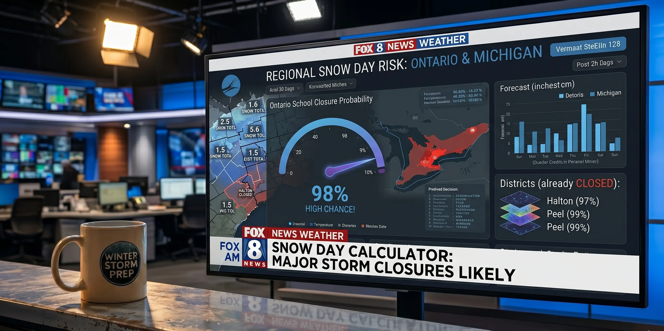
Reigonal Snow Day risk.
Common Mistakes People Make With Probability Scores
Even with a well-calibrated probability snow day calculator, there are predictable ways people misuse the output. Avoiding these mistakes will make your planning significantly more effective.
Mistake 1: Treating any score above 50% as a definite snow day. A 55% probability means school is closed slightly more often than not in comparable situations — but it's genuinely close to a coin flip. Making full alternate arrangements for a 55% score is reasonable; treating it as certain is not.
Mistake 2: Ignoring the score because "the weather app says something different." A weather app shows you how much snow is coming. A probability snow day calculator translates that snow into a closure likelihood. They answer different questions. Both are useful. Neither replaces the other.
Mistake 3: Checking once and never coming back. A score you checked at 6 PM on Tuesday may be significantly wrong by 11 PM when the next model run drops. The most accurate read is always the most recent one. Check your probability at least twice — once the evening before and once in the early morning hours on storm day.
Mistake 4: Applying national interpretations to regional scores. An 80% score in Alabama carries far more weight than an 80% score in Wisconsin. Southern districts close at lower thresholds and behave more predictably at high probability scores. Northern districts have more gray area at equivalent scores. Always factor in your region when interpreting your number.
Mistake 5: Expecting the calculator to override the official decision. A 95% probability that school closes does not mean school will close. It means it almost certainly will. The official decision belongs to the superintendent. The calculator helps you anticipate and plan — it doesn't make the call.
Frequently Asked Questions About Snow Day Probability
If my probability is 50%, should I plan for a snow day or not?
A 50% probability is genuinely a coin flip — the model is telling you it has no strong directional signal either way. The right response is not to commit to either outcome but to take low-cost preparatory steps: have a backup childcare contact identified, give your employer a heads-up that tomorrow is uncertain, and recheck the score at midnight and again at 5 AM. By morning, the score will almost always have moved meaningfully in one direction.
Can I get separate probabilities for a full cancellation and a 2-hour delay?
Yes — SnowDay Calculation outputs distinct probability scores for full cancellation, 2-hour delayed start, and normal school operations. This distinction is important because delayed starts are the most common response to borderline storms, and knowing that a 65% "closure" score actually breaks down as 30% full cancellation and 35% delay changes what you should plan for. A delay requires 2 hours of coverage; a full closure requires a full day.
Why does my score seem high when the forecast only shows a few inches?
Accumulation total is just one input into the probability model. A forecast showing only 2 inches of snow can still produce a high probability score if that snow is forecast to fall between 4 AM and 7 AM (worst possible timing), if temperatures are near 20°F (high ice risk), if the storm involves any freezing rain, or if your district is located in a region where 2 inches historically triggers closure. The score reflects all of these factors together — not just the headline snowfall number.
Check Your Real-Time Snow Day Probability Now
SnowDay Calculation's probability snow day calculator pulls live NWS grid-point data, weighs it against your district's actual closure history, and outputs a calibrated probability score for full cancellation, delayed start, and normal school — updated every time you load the page. Enter your zip code and know exactly where you stand before the storm arrives.
Get My Snow Day Probability Score ❄️